
Using QGIS
Overview
This section provides examples of interacting with wis2box API using QGIS.
QGIS is a free and open-source cross-platform desktop GIS application that supports viewing, editing, and analysis of geospatial data. QGIS supports numerous format and encoding standards, which enables plug-and-play interoperability with wis2box data and discovery metadata.
Accessing the discovery catalogue
QGIS provides support for the OGC API - Records standard (discovery). To interact with the wis2box discovery catalogue:
from the QGIS menu, select Web -> MetaSearch -> MetaSearch
click the “Services” tab
click “New”
enter a name for the discovery catalogue endpoint
enter the URL to the discovery catalogue endpoint (i.e.
http://localhost/oapi/collections/discovery-metadata)ensure “Catalogue Type” is set to “OGC API - Records”
click “OK”
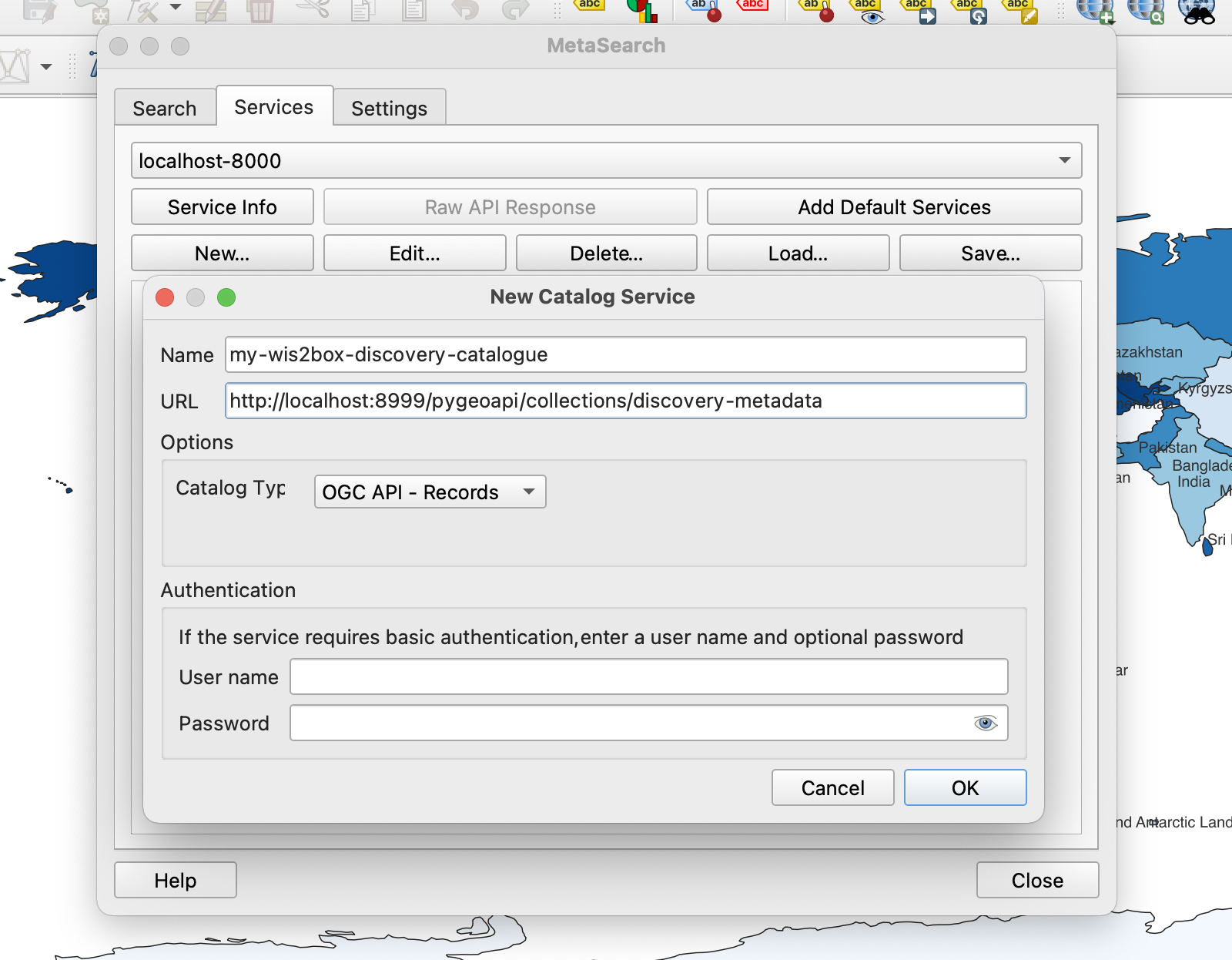
This adds the discovery catalogue to the MetaSearch catalogue registry. Click “Service Info” to display the properties of the discovery catalogue service metadata.
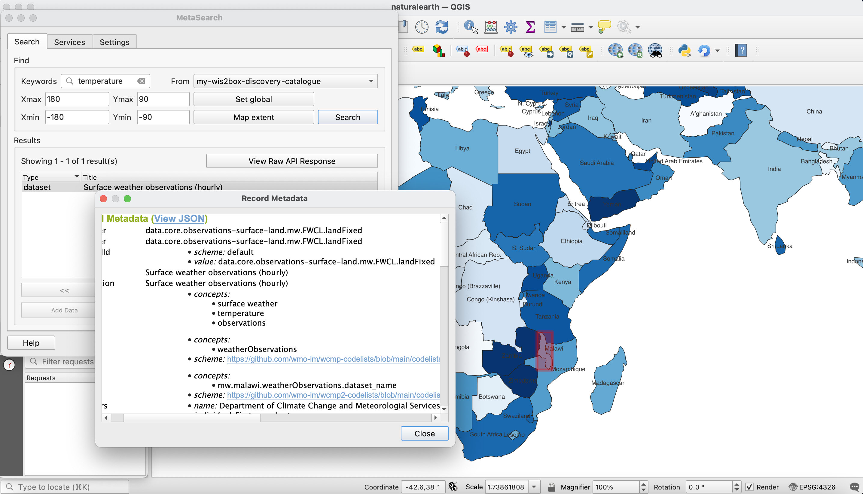
To search the discovery catalogue, click the “Search” tab, which will provide the ability to search for metadata records by bounding box and/or full text search. Click the “Search” button to search the discovery catalogue and visualize search results. Clicking on metadata records in the search result table will show footprints on the map to help provide the location of the search result. Double-clicking a search result will show the entire metadata record.
Note
For more information on working with catalogues, consult the official QGIS MetaSearch documentation.
Visualizing stations
QGIS provides support for the OGC API - Features standard (access). To interact with the wis2box API:
from the QGIS menu, select Layer -> Add Layer -> Add WFS Layer…
click “New”
enter a name for the API endpoint
enter the URL to the API endpoint (i.e.
http://localhost/oapi)under “WFS Options”, set “Version” to “OGC API - Features”
click “OK”
click “Connect”
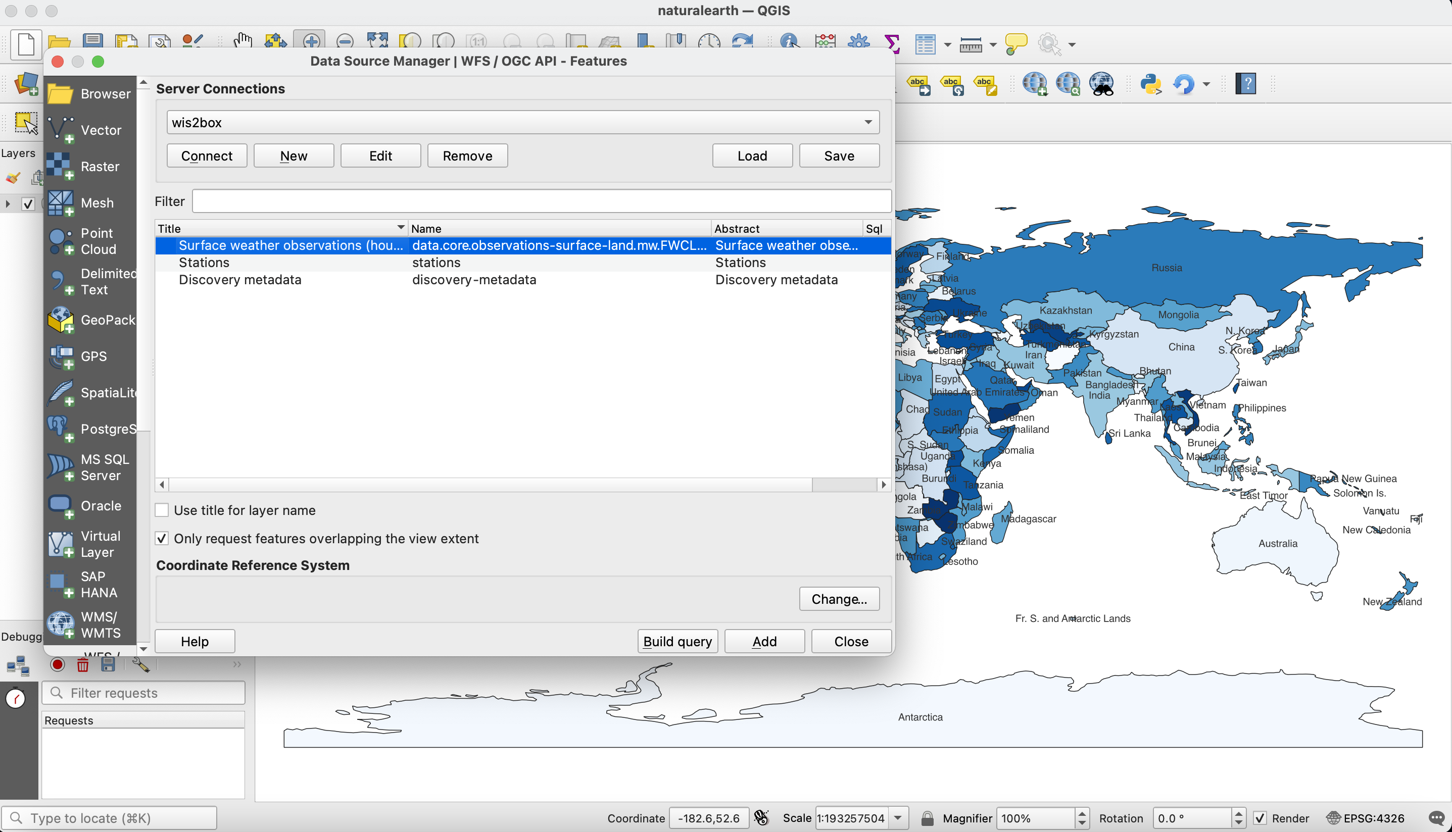
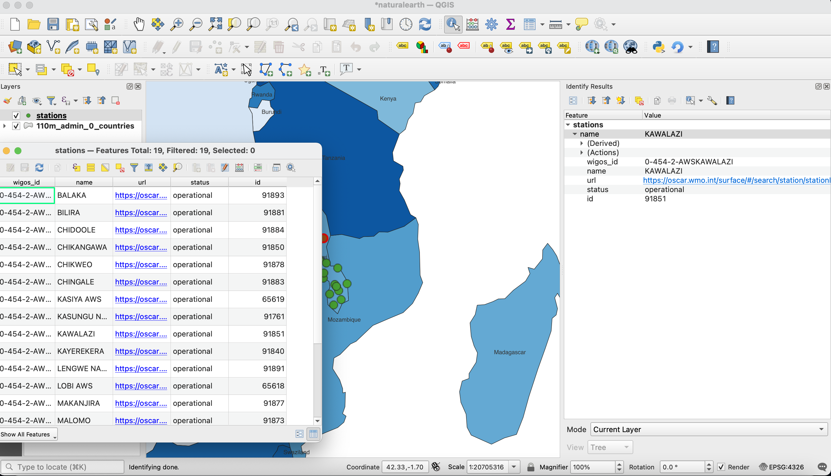
A list of collections is displayed. Select the “Stations” collection and click “Add”. The Stations collection is now added to the map. To further explore:
click on the “Identify” (i) and click on a station to display station properties
select Layer -> Open Attribute Table to open all stations in a tabular view
Note that the same QGIS workflow can be executed for any other collection listed from wis2box API.
Note
For more information on working with OGC API - Features, consult the official QGIS WFS documentation.
Summary
The above examples provide a number of ways to utilize the wis2box API from the QGIS desktop GIS application.